The 2nd annual Wheelmen Zodiac (multi-day bike outing) to Mt. Shasta was another great success. Beautiful weather, totally awesome scenery and many fine ride options organized by Dale Johnson and Dennis King, our c0-ride leaders, were spread over 5-days. About 18 cyclists participated in this year's event.
With the region receiving more than 168% of normal snowfall this season, the surrounding mountains were covered with a blanket of white and the rivers and creeks were cranking. The scenery around Mt. Shasta is breathtakingly beautiful.
In 5 days, the daily rides I participated in totaled 211 miles and climbed 14,730'. This is an amazing place to ride a bike. The roads are in great shape, low-trafficked, and omni-present Mt. Shasta, at 14,162', is mesmerizing.
On this outing, we rode around the northern, western, and south-eastern flanks of this magical mountain.
For enlarged view, click once/twice on pic

The Mt. Eddy range (9,025') at sunset viewed from Mt. Shasta City
 View of Mt. Shasta from across the valley on Castle Lake Road
Day 1 - a short ride but long 7 mile climb to Castle Lake - 22 mile RT with 2,533' of vertical gain.
 View across the valley with Mt. Shasta City nestled at base of mountain
Frank and Herb on Castle Lake Road at about 5,000'

It's late June and Castle Lake at 5,440' is still nearly frozen over (above and below)


Butting heads with Frank
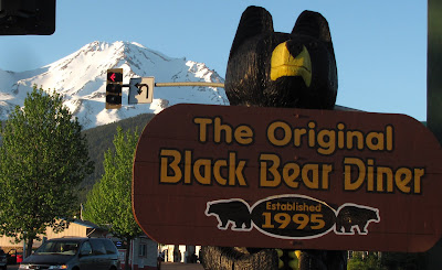
 The Black Bear Diner with over 30 restaurants started here
Mt. Shasta City, situated at the western base of Mt. Shasta is a very spiritual and mystical town. It has a compact and quaint downtown full of nice eateries and shops catering to outdoor adventurers, bookstores, art galleries, and many new age businesses.
This unique town has great karma!

Seven Suns Coffeehouse is a local hot spot serving great java, pastries and casual lunches. This cafe draws a very interesting and diverse clientele.
 Bob pounding abalone into flat fillets
A special treat on this zodiac. Bob Barker who just came over from a fishing trip to the North Coast served fried abalone to the entire gang.

Bob frying up abs in his propane powered wok

What a rare treat - everyone scarfing up on delicious fried abs and potato salad

Man vs. Ab

The Thumb of Castle Crags viewed from Mt. Shasta City

Bob A, Frank, Herb, Tom G, Tom A, and Harold at rest-stop on No. Stage Road
Day 2 - 54 mile ride with 3,860' of climbing along the eastern flank of the Klamath range

Ripping South Fork of Sacramento River

Tom G and Herb riding up W. A. Barr Road to turn-around point

Tom A with Mt. Shasta looming in horizon

Gordy pounding his way up the road . . .

. . . and cooling off in a tumbling stream

Gordy, Bob A, Herb, and Tom A taking a break

Group shot on bridge at turn-around point

Front - Rich, Tom G, Frank, Herb
Back - Me, Bob A, Dale, Bob B, Harold, Tom A, Gordy, Steve A
 Riding into the Little Shasta Valley and Montague
Day 3 - 68 mile ride with 1,887' of climbing

View of volcanic hummocks and north-side of Mt. Shasta from Little Shasta Valley

Riding through scenic Little Shasta Valley

Little Shasta Church est. in 1878

Passing old cemetery
 Is this the right way?
We think we're lost and confer with our route map

Another breath-taking view of Mt. Shasta, the north-side

The north-side of Mt. Eddy is still covered with tons of snow

Can't have enough shots of Shasta

We take a side-trip to look at Lake Shastina, a private housing development surrounding lake
 Lower Falls (Fowler Falls) on McCloud River
Day 4 - a 43 mile ride with 3,123' of climbing toward McCloud and views of three great waterfalls

Lower Falls was cranking

Buddhist monks taking to the magic waters
 A nice catch!
The lads at Lower Falls overlook

Roaring Middle Falls

The lads gawking at nude sun bather. Go back to previous photo and click twice and view lower right corner :-). Hey Rich, did you get a good pic?!!

Upper Falls blasts out of narrow opening

Tumultuous river flows through narrow gap above Upper Falls

Team Cervelo rider
 Big Dennis
Human snow plow meets wooden plow at McCloud train yard
 View of Castle Crags from road up Mt. Shasta
Day 5 - 25 mile RT ride with 3,327' of climbing on Everett Memorial Hwy up Mt. Shasta
 An amazing view !
Herb heading toward Bunny Flat on way up Mt. Shasta

Cruising into Bunny Flat, the end of the road

Bunny Flat, end of the road at 6,950'

Still tons of snow above 7,000'. The road closed at this point.

A couple mountain climbers heading out
 Dale Johnson, zodiac leader
Another fantastic Wheelmen Zodiac led by Dale and Dennis King. Thanks lads for organizing a superb 5 day outing.
 Ted the Titan
 Mike taking a whiff
 Tabatha the Titan, the female titan arum is a very tall plant about 10' in height. It bloomed once in 2004.
 The lads strolling through the conservatory and checking out the other cool plants. The following pics show some of the other exotic plants on display.


