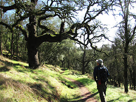
 Thanks to the American River Conservancy, the region has added a fantastic new multi-use trail to the growing list of hiking options in the Sierra Nevada foothills. The latest is the South Fork of the American River Trail, an 8-mile long path connecting Salmon Falls Road to the Cronan Ranch Open Space on Hwy 49.
The new trail follows the north side of the South Fork from Folsom Lake to Hwy 49 near Coloma. From the Salmon Falls Bridge, the trail ascends steeply - about 400 vertical feet - to the top of a ridge which offers commanding views of the surrounding hills and valleys. The trail continues easterly over several hills with short steep climbs and descents into and across side canyons.
For the first 4+/- miles, the trail stays high above the river following the canyon's northern ridge before dropping down to the river's edge at about the 5 mile point.
The primary habitat is manzanita chaparral, gray pine and oak woodland.
Today, Herb and I took advantage of break in the weather and hiked 5 miles (10 miles RT) of the new 8 mile trail. With above normal rainfall this winter, the hills have already turned green.
With clear blue skies, it was a beautiful day for a hike exploring another new region of the foothills.
Next time, we plan to do a through hike.
Click on pic once/twice for enlarged view
 Southwesterly view of Salmon Falls Bridge and So. Fork entering Folsom Lake. We parked next to the bridge and hiked 5 miles of the new trail.


No comments:
Post a Comment