


 We flew into Buffalo where we started our 5 week adventure.
The following 5 blog entries - Places in Between - chronicle areas we traveled through between the places highlighted in the previous section.
 The beautiful stretch of the Erie Canal where it meets the Niagara River
 Gateway to the Erie Canal
 Entering Canada in Niagara Falls
 Stopping by a Buddhist Monastery leaving Niagara City
 Gondola crossing "Whirlpool" in the Niagara River Gorge, several miles downstream from the Falls
 The "Niagara Whirlpool", a bay created by a big turn in the Niagara River
 We followed the Great Lakes Seaway Trail along the southern shores of Lake Ontario
 A beautiful stretch of the Seaway Trail
 Arriving at Lake Ontario where the Niagara River flows into the lake
 Visiting Fort Niagara, the oldest continuously occupied military site in North America. It was originally built in 1678 to protect the interests of France in No. America.
 The Fort is situated on a strategic site at the confluence of the Niagara River and Lake Ontario
 The French Castle built in 1726
 Docents gave a good presentation of Fort's history
 The Fort was expanded to its present size in 1755 due to increased tensions between the French and British colonial interests. The Fort played a significant part in the French-Indian War, and fell to the British in 1759.
 Through the American Revolutionary War, the Fort remained in British hands. It was ceded to American forces in 1796, but later retaken by the British in the War of 1812.
The British relinquished the Fort to the US in 1814 upon the signing of the Treaty of Ghent which ended the War of 1812.
The Fort has remained under US control ever since.
 Lighthouse next to Fort Niagara
 Hwy 18-F, a nice highway with good shoulder follows the southern shore of Lake Ontario
 A beautiful stretch of Hwy 18-F through some boutique neighborhoods
 An evening stroll on the Lewiston waterfront

 Fisherman lands a 37" pike

 Separated at birth . . . see next pic of Tom

 Upstate NY is primarily farmland
 My first fried haddock, a common whitefish served throughout New England
 Camping at Lakeside Beach State Park on the shores of Lake Ontario
 At Brockport, we cross over the Erie Canal
 Coleen's, a great diner in Brockport
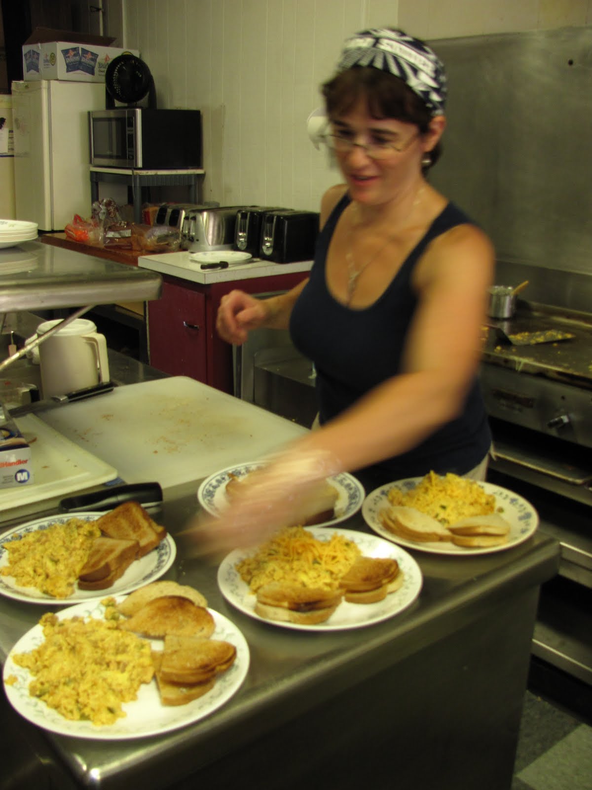 Coleen runs the cafe single-handed and whips out a mean breakfast scramble
 Downtown Brockport (above and below), neat college town

 I get a kick out of Americana food history and talked the lads into stopping off at the Jello Museum in the village of LeRoy.
A few years ago, I visited the Spam Museum in Austin, MN. Now I can check off the Jello Museum :-)
 Museum houses memorabilia related to everything Jello
 There's always room for Jello

 At the Genosee County RV Park in LeRoy where we camped, a custom trike confab was taking place. Here's a few of the really cool trikes . . .


 We stop at Bob's namesake cafe for breakfast
 More evidence of farm country in up-state NY

 As we proceed east to the Finger Lakes, we begin to encounter bigger hills. Note the width of shoulders. This was very common in up-state NY, making cycling safe and enjoyable.
 Arriving at Lake Canaandaigua, the first of the Finger Lakes
 It's time for a DOG!
 A sign describing history of Finger Lakes. Click on pic for enlargement.
 The Finger Lakes region is the Napa Valley of New York and we rode by many vineyards and wineries

 Stopping for another DOG!
 Randy, the owner, cooks up some great dogs
 Quite tasty!
 Vineyards above Senaca Lake
 Another great winery sign
 Daily ritual
Breaking camp at Watkins Glen State Park
 Leaving Senaca Lake on 11% grade

 Heading to Ithica and more rolling hills

 Hey, Bob, are you having fun yet!?
Bob hates rollers!
 A photogenic decrepit barn
 Silo or observatory?

 Rollers are getting smaller as we approach Ithica
 A odd farm equipment crossing the road
 A visit to Upper Falls of R. Treman State Park
 Another beautiful gorge

To continue tour, scroll down or click on "older post"
1 comment:
Glad to see you were really riding bikes...
Post a Comment