


 Fence Post Art
If you keep your eyes peeled for odd objects, you will find them. This funny guy in a shell was placed on a fence post next to a rock on Hwy 36. I get a kick out of finding stuff like this.
 Red Ryder meets Fat Tire
"Ride, eat, sleep, explore" is the mantra of ACA (Adventure Cycling Assn.) for cycle touring and what an understatement. These four words aptly describes what one does on a daily basis on an extended tour. Life on two-wheels gets pretty simple and it's GREAT!
For 18 days, the foursome of Bob Anderson, Frank Gerace, Dennis Engblom and I explored the NW corner of California taking mostly little used back country roads to some of the most breathtaking country you will encounter.
We started and ended the tour in Sacramento and covered 683 miles and climbed 31,496' and crossed 10 county lines (Sacramento, Yolo, Colusa, Glenn, Tehema, Trinity, Humbolt, Mendocino, Lake, and Napa).
I did this big loop ride 5 years ago and essentially followed the same route with a deviation on the first 3 days due to inclement weather. We wanted motels and not campgrounds based on the extended forecast.
The tour route followed Old Hwy 99 W from Woodland to Red Bluff then turned west on Hwy 36 to Fortuna on Hwy 101. We proceeded south on Hwy 101 to Leggett, turning west on Hwy 1 to Mendocino. We then turned east on Comptche/Ukiah Rd which becomes Orr Springs Rd to Ukiah. We continued east on Hwy 20 and Scotts Valley Rd. to Lakeport, then southeast on Bottle Rock Rd./ Hwy 175 to Middleton.
The final leg was on Butts Canyon Rd./Pope Valley Rd. to Moskowitz Corner, finally turning east on Hwy 128 to Winters/Davis and returning to Sacramento over the Causeway.
 Bon Voyage! See ya' in 18 days!
Meeting the Wheelmen on their breakfast ride on Front Street - Debra, Lesli, Eric and John and Sally.
 Slow getting out of town. Tower Bridge lifting for a passing boat.
 Steve and Mike accompanied us to Woodland where we said our good-byes. Mike and a group of five will be starting a cross-country bike trip in a couple days.
Good luck and safe travels to you Mike!
 Passing flowering crop on Old Hwy 99 W (above and below)
 The barren Dunnigan Hills at sunset is sublime
 Riding on Old Hwy 99 is like riding through the Mid-west where Ag is King
 A daily morning ritual - stopping off in Arbuckle for a caffeine jolt.
 Sutter Buttes to the east
 Passing under the Williams Gateway Arch
 Old Hwy 99 is lined with many silos
 YES! The flag pointing north, the direction we're riding!
With storms blowing in from the south, we had tailwinds for 3 days going to Red Bluff. There is an upside to rain.
 We got our first drenching on the 3rd day - from Orland to Red Bluff
 Slick roads leaving Orland
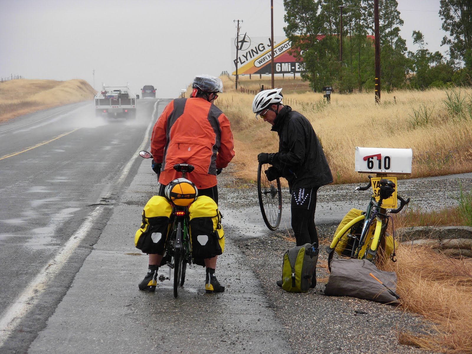 Dennis gets another flat, the second of six for the entire trip
 We laid over in Red Bluff and checked out the town. Historic church (above) and courthouse (below).
 Note to foodies: The Countryside Cafe, probably the best eatery in town, is located directly across the street from the courthouse. Famous for homemade pies!
 The sun popped out for a short time for a local to check out the wildflowers
 Frank the bumble bee
 A great day - sun out and riding on beautiful Hwy 36
 Hwy 36
Rolling hills, meandering roads and splendid views
 Bob rolling along
 Hwy 36 heading into the first range
 Platina Grade, the first big climb on Hwy 36 - about 4 miles long at 4-9%
 Two riders on Platina Grade
Click twice on pic to see Bob and Frank grinding up the grade
 Frank chasing Bob
 Frank closing in for the kill
 Can't be that tough, Bob is smilin' . . . or is it a grimace?
 A Wowser! A bouquet of wildflowers on a south-facing slope
 I had to stop to smell the poseys
 Our first night camping at Basin Gulch, a NFS campground.
 A beautiful little creek flows through the campground
 Laura flipping jacks
Bountiful breakfast at Wildwood Cafe
 Paulina is a friendly and efficient waitress
 Frank finds his hometown
 First sighting of snow-capped Trinity Alps
 A giant snow cone - Mt. Shasta
 The lads posing in front of Trinity Alps at highpoint on Hwy 36
 At viewpoint at South Fork Summit with view of Lassic Range behind us
 It's all downhill from here
 Arriving at Ruth Lake
 We camped behind cafe/bar in very rustic setting
 A well maintained cabin at Ruth Lake - felt like "Deliverance Country"
 Oh feed me!
Love the expression!
 Another flat on big descent to Van Duzen River
 Van Duzen River
 Nice campground at Grizzly Creek State Park next to Van Duzen River
 Cresting last hill into Hydesville near Fortuna
 Needless to say, Frank had to stop here
 Beautiful river valley near Hwy 101, south of Fortuna
 Cruising through the tall trees on The Avenue of the Giants
 With threatening rains, we booked a small cabin in Redcrest
 Frank drew the short straw and curled up in the corner
 Another java jolt at Meyers Flat
 I can relate!
 The mighty Eel River follows Hwy 101 for many miles
 Stopping off at the Benbow Inn for a break
 The old highway below Hwy 101 bridge
 Frank draws the short straw again and had to settle for the roll-away
Booking into the Redwood River Resort cabin
 Dennis cooks up a mean spaghetti dinner
 It was quite tasty!
 From Leggett, Hwy 1 climbs 4 miles at 7% grade
 At the summit!
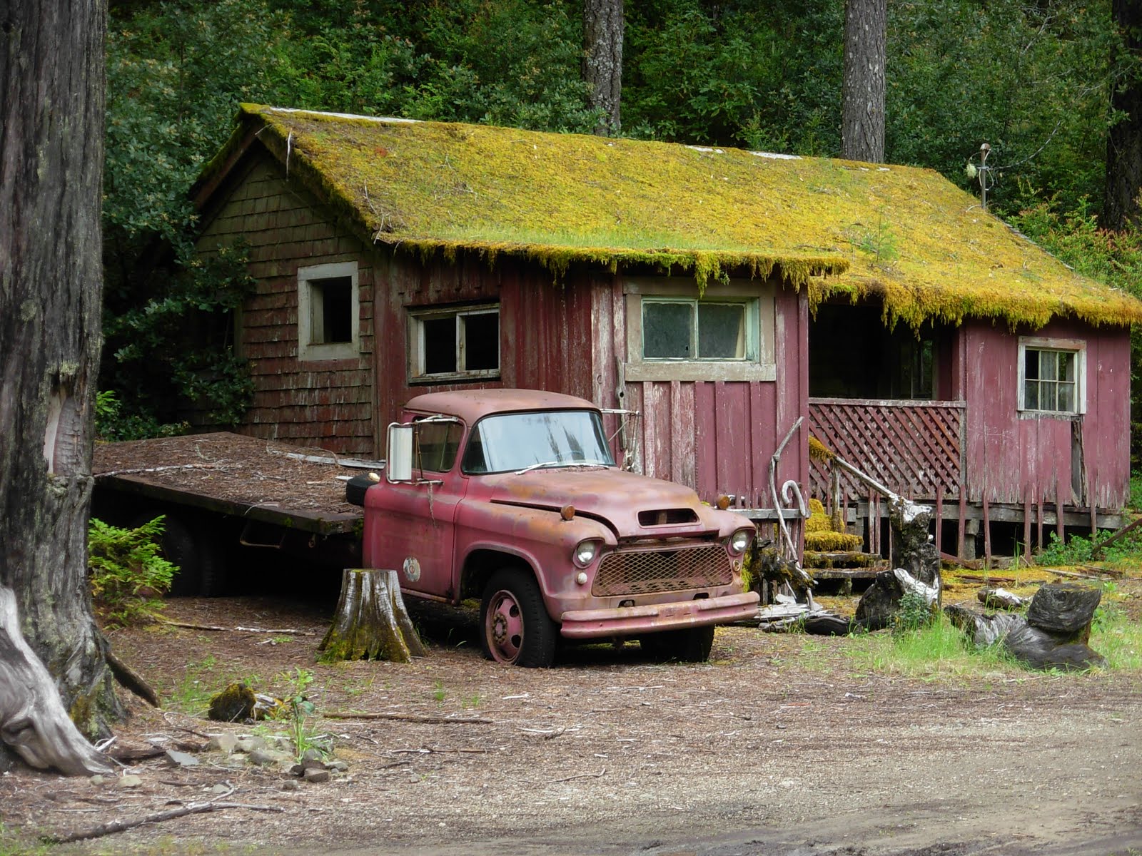 I hear banjo music!
Another Deliverance Country scene
 Hwy 1 is well marked for cyclists
 A marine layer gives hint of approaching ocean
 We hit the coast!
 Hwy 1 near Lost Coast
 Another major accomplishment, reaching the Pacific on Day 12
 Riding south on Hwy 1 toward Westport
 Neat scene in Westport
 After a break in Westport, we continue south
 Hwy 1 has many swooping descents and short climbs
 More scenes along Hwy 1

 A trick shot. Click twice on pic to view close-up of Bob in mirror.
 A neat swooping bridge crossing Ten Mile Creek
 Booking a bike/hike campsite ($5/each) at MacKerricher State Park
 A Gray Whale big enough to swallow 3 people
 Exploring MacKerricher Beach
 Boardwalks to bluff overlooks to view sea lions and harbor seals
 Pudding Creek Cove
The new Ten Mile Road Bike Path from MacKerricher SP to Ft. Bragg allows you to stay off Hwy 1
 New bike/ped bridge crossing Pudding Creek to Ft. Bragg
 The Little Stinker
The Skunk Train in Ft. Bragg
 A great place for breakfast in Ft. Bragg
 Headland scene north of Mendocino
 A friendly birder allowed us to check out the birds nesting on the rocks
 The Big Lebowski consuming apple desert at Mendocino Cafe
Bob has an appetite to behold!
 Quaint scenes of Mendocino - an artist mecca
 My buddy "Geno"
Cool bench sculpture at Little River Inn
 Little River Cove at Van Damme State Park
 Another great bike/hike campsite at Van Damme
 Ya' think it rains alot here?!
Storage box with toupee
 Little River Market/Deli has a view of ocean
Note to Foodies: The "best find" for reasonable eats on Mendocino Coast
 The airport scene from Same Time Next Year, one of my favorite movies was filmed at this airport.
 Wild Rhodo with a smile
 Checking out the Pygmy Forest on Airport Rd.
 Enough of the frivolities. Time for serious climbing on Orr Springs Rd. First of two double digit monster climbs.
 What the heck?!
Looks like Tibetan yak cows in Mendocino County. Click twice on pic for close-up view.
 An old lumber burner. Don't see too many of these anymore.
 The tough climbing begins after leaving Orr Hot Springs Resort. Double digit grades (10-20%) for 6 miles.
 Frank grinding his way up. Click twice on pic to see Frank sweating.
 Monster climb but the scenery is superb
 Hey Dennis, yur' only half way up! Sorry Man!!
 More torture scenes of Frank (above and below)
 Cows are loving it out here. It'll be a good year for cheese.
 Near the summit
 A bench at the summit
Smile Dennis, the hard climb is over
 "It would be easier if I lost 30 lbs"
Big Bob's comment after every climb - a broken record.
 Brake check time!
From the summit, a screaming 10% descent to Ukiah
 Heading to Lakeport on Scotts Valley Rd.
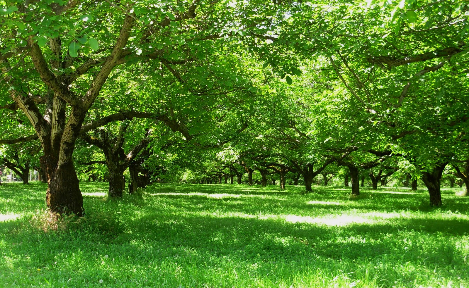 Beautiful orchards around Lakeport
 Best Campground Award
We staked out a lake front site at RV Park
 Nice grass, lake view, great eatery 100' away - Doesn't get any better than this
 Lounging around before walking over to TNT Cafe on the Lake for dinner
 Fantastic Mexican eats at TNT
 Fabulous fish tacos
 From the deck, I watched night herons flying back and forth with nest material in their bills.
A flock of about two dozen herons were building nests in a nearby sycamore grove. Click on pic twice for close-up view.
 Another bonus - flying saucer clouds at sunset
 Stopping off for good ol' Joe in Kelseyville on our way to Middleton
 Best Motel Award
Twin Pines Casino in Middleton
 No curling up in the corner or roll away for Frank tonight. A big cushy bed is heaven!
The cafe was pretty good too.
 Being chased by Jaws
On our last leg, heading east on Butts Canyon Rd. to Lake Solano Campground
 New vineyards flourish in Pope Valley
 The remodeled Pope Valley Store caters to cyclists
 Great weather! Great views! Touring at it's best!
 The last grinder - the backside of Cardiac Hill
 Big Bob and Frank grinding to the top
 The Glory Hole
Still alot of freeboard in Montecello Dam before water flows into the Glory Hole
 Baby peacocks at Lake Solano Campground
 Bob Tribe drives over and meets us at Putah Creek Cafe in Winters for our last breakfast.
He picks up the tab for the group. You the Man BT!
 Only 30 miles to go to Sactown
 State Capitol or Bust!
Mission Accomplished! Back home after 18 days and nearly 700 miles.
End of a awesome tour.
4 comments:
Wow..great tour..scenery was awesome..campsites so nice..hee hee..those cabins with mossy roofs..
I saw the smile in the Rhodo before i read what your wrote..very cool.
Looks like another amazing tour..
So..are you resting now?
wow! awesome trip and photos! I want to do something like that someday! How did you fit all your stuff on your bike?
awesome pictures and trip! Always wanted to do something like that!
Just. Came across your pictures! Wow! What an amazing trip
Post a Comment