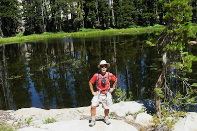
Our third annual trek to the Eastern Sierras took place between July 28th and August 3rd. We base-camped at the Brown's Owens River Campground near Mammoth Lakes for 6 nights at an elvation of approximately 6,900'.
The weather was warm but not overly hot and perfect for our hiking and biking outtings.
The Yosemite fires caused some smokey days but a strong north wind kicking up at mid-afternoon blew out most of the smoke and haze.
On this trip, I was joined by Herb Lee, Dennis Engblom; Jim Mullen and Dan The Man from Grass Valley; Jay Okada, Reza, Ralph and Kathy Battles from SLO
Rich Blackmarr, Mike Donohue, Mark and Julian Manoff came down for two days and joined us for the Mt. Mogan Hike
The blog entry for the Eastern Sierra trip is composed of four entries:
Part 1 - Mt. Morgan hike
Part 2 - Cycling Rock Creek Road
Part 3 - Hiking Devil's Post Pile and Rainbow Falls
Part 4 - Camping out at Owen's River Campground
Note: To view enlarged photo, mouse over picture and clickPart 1 starts below:

Dan points toward Mt. Morgan, elevation 13,758', the tiny peak on the big mountain in the middle.
From the trailhead at Rock Creek Lake, elevation 9500', the route to the summit is a challanging 6 mile hike.

Group foto of Team Flomax at Francis Lake - Dennis, Mark, Dan, Jim, Jay, Me, and Reza.
Herb taking pic. Missing Ralph, Mike, Julian and Rich.

At the higher elevations, the wildflowers were in full bloom. The meadows were quite beautiful.

The difficult part of the hike begins after leaving Francis Lake. For the remaining 2+ miles to the top, you have to slog through massive boulder fields which are quite treacherous. There is no defined trail and you have to pick your way the best you can.
In the pic above, Dan takes the steep approach to the next ridge.

Ralph, Reza and Jay begin picking their way up the first boulder field

Where's Waldo?
Can you find Ralph in the foto?
The lower boulder field above Francis Lake is a massive jumble of huge rocks and boulders. This was the most difficult part of the hike to navigate. Footing was treacherous and we could easily get disoriented and lose our way to the summit.

Herb and Jay makes it safely to the top of the first ridge after weaving their way through the massive lower boulder field

Time for lunch - L-R Jay, Herb, Ralph, Dan and Jim

I pick up my pace on the next leg. The others are down the slope.

At around 12,500' and looking down on several lakes to the northwest. Rock Creek Lake is the one on the right. This is where we started the hike.

Jim nearing the top. Still more sharp boulders to traverse.

I'm nearing the top. Only about 500' left to go.

Awesome is an over-used word but appropriate here. Views to the south from the summit.

Views to the southwest

Views to the northeast. The White Mountain range lies across the Owens Valley.
Note the sharp drop-off right below us.

A major hump to the west

Yee haa! Jim is almost to the top

Ralph is the 2nd one to make it to the top

Jim, Ralph and Dan at the summit. Herb arrived about an hour later. Of the 11 hikers who started the hike, the five of us were the only ones to summit Mt. Morgan.
It took us about 10 hours to complete the 12+/- mile RT hike

ON TOP OF THE WORLD
This weekend was another milestone day for me. August 3rd would have been Patti and my 40th wedding anniversary. She passed away on April 4th so I dedicated this hike to her.
She was with me in spirit and helped me power up the mountain. My rapid pace was attributed to her angel wings carrying me up the mountain.
After cresting the summit, we all yelled "Happy 40th Anniversary Patti!!"
While at the top, a white-throated swift came whizzing by my head a couple times. Patti and I were passionate birders. I took this as a message that she acknowledged my presence.
 On a warm August day, I took a drive to Napa Valley to help a wine-making friend of Dick's, Jerry Hill and his wife Andi, bottle a couple barrels of pinot noir wine. Jerry, a home wine-maker is going big-time and bottling wine for resale.
 The winery where the bottling took place is located at a friend of Jerry's in the north-end of the beautiful Napa Valley. Jerry buys grapes from Napa Valley and Amador County and crushes the grapes and processes the wine here.


