Friday, July 1, 2011

Sensory Overload

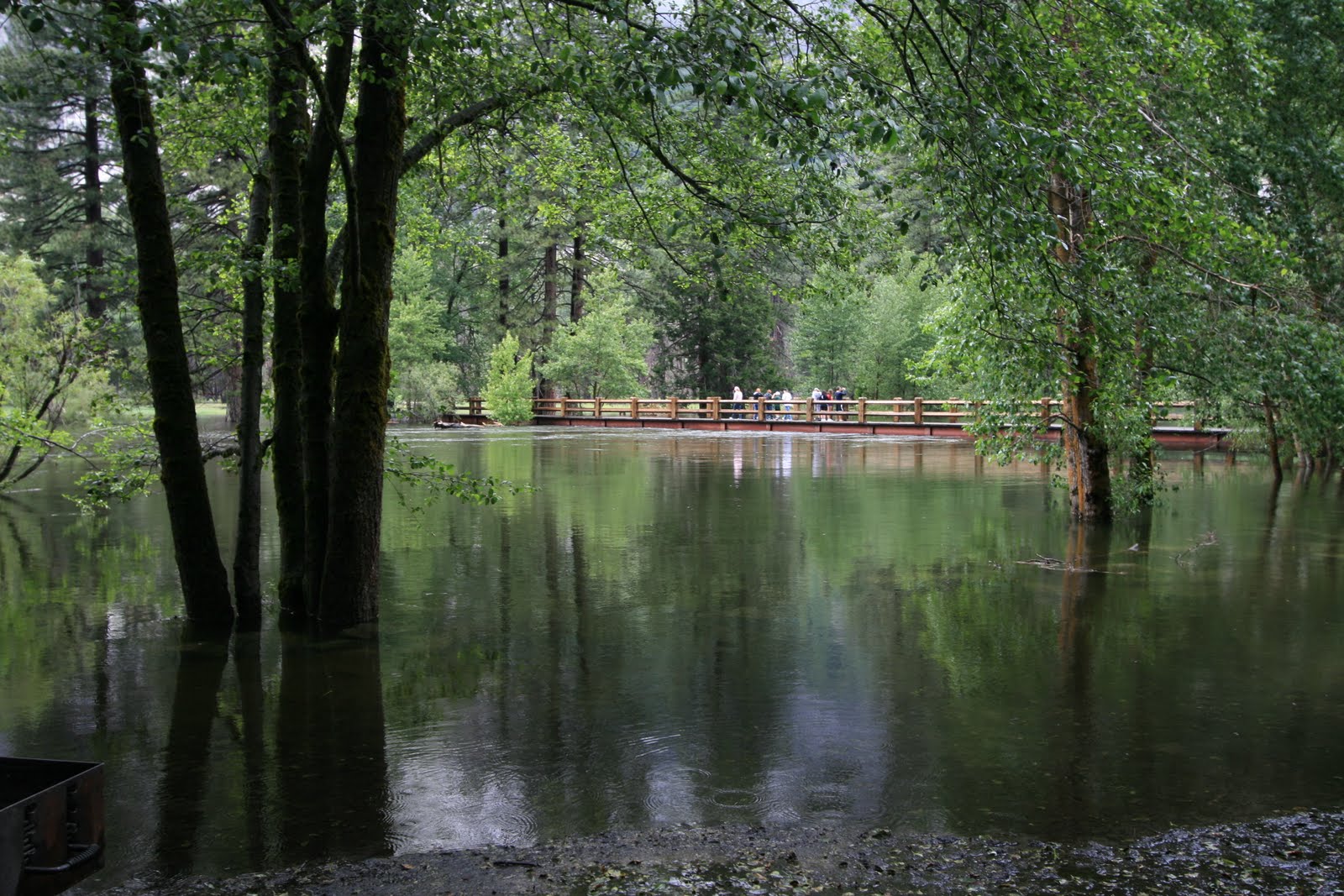
Pumpin', crankin', rippin' . . . pick your adjective. With the formidable snow pack this season, the deepest amount ever recorded this late in the year, dating all the way back to the construction of the Transcontinental Railroad in 1868, the waterfalls in Yosemite were flowing at the highest rate in generations.

The media coverage of the raging waterfalls made national news so needless to say, I had to check it out. It was time for a road trip. Seeing the snow-capped Eastern Sierra Mountains was also on my bucket list so I decided to take 3 days and take a swing through the Central Sierras by way of Tioga Pass Road, which was just opened.

All the stars were aligned to see some of the most incredible natural wonders of the world in one short trip. Taking in all this scenic beauty was mind-blowing. My mind and senses were on max overload!

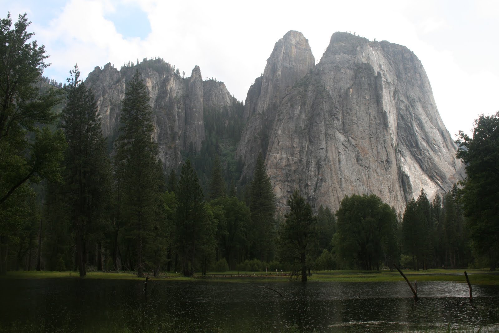
First, my route took me down the central valley into Yosemite via Hwy 120.

I spent 1 1/2 days in the Valley checking out all the major waterfalls. The second day I hiked up the classic route to see Vernal and Nevada Falls, a must do hike. Getting up close to raging Vernal and Nevada Falls is a rush of a lifetime.

The 2nd day, I left Yosemite Valley and drove Tioga Pass Road over the high Sierra range to Lee Vining. I took Hwy 395 south to Bishop and spent the remainder of the day at Sabrina Lake at above 9,000'.

The 3rd day I drove north on Hwy 395 past Mammoth Mountain, took the June Lake Loop, and continued up Hwy 395 to Monitor Pass Road. I drove over Monitor Summit and returned to Sacramento via Markleeville, Caples and Silver Lakes, and Jackson.

I logged about 750 miles making this big loop. In my humble opinion, this specific route is one of the most beautiful drives in California, if not the US. See if you agree.

The following blogs chronicle my 3 day trip. The entries are categorized as follows:

Part 1 and 2 - Yosemite Valley waterfalls and other cool sights
Part 3 - Tioga Pass Road
Part 4- Eastern Sierra views along Hwy 395

Continue to scroll down or click on "older posts" to view all entries.

To see enlarged view, click on pic once/twice


Yosemite - Part 1

First stop, Bridalveil Falls. I drove up to Tunnel View to take in great views of the Valley and B-Falls from a distance. Later, I walked up to the base and caught a neat rainbow.


The thunderous flows generated a huge mist at the base resulting in a spectacular rainbow


Hikers getting blown away by the wind and mist generated by the huge waterfall


Tumultuous creek cascading below B-falls into Merced River

View of Valley, El Cap, Half-Dome, and B-falls from Tunnel View

Hi there!

Tunnel View offers one of the best views of the Valley

Next stop, Yosemite Falls.
A storm passed through the Valley with low hanging clouds obscuring the upper part of Yosemite Falls

Wide angle view of Yosemite Falls

Upper Yosemite Falls as it gushes over the brink

Click on pic twice to see people on ledge above upper Yosemite Falls . . . talk about gutsy!

Too scary for me!

Views (above and 2 below) of base of upper Y-falls. Great flows creating thunderous sprays.


The trail to the top of Y-falls climbs up the crevice to the left of waterfall (above and below). One would definitely get drenched hiking to the top this year.


View of base of Lower Y-falls

Some folks came prepared with raincoats

Bridge crossing raging creek at Y-falls base

Stream from Y-falls flowing down to Merced River

Passing huge granite wall on hike to Vernal Falls

The best view of V-falls is from John Muir Trail. Click on pic twice for amazing sight. Can you feel the roar?!

Amazing amount of water cascading over the edge

White knuckle time on the edge


Lean back a little more would ya!

Rampaging Silver Apron above V-falls (above and below)


Hikers coming up Mist Trail

Getting a closer view of V-falls


Me at the edge

Looking over the edge

Another neat rainbow above Mist Trail

Scroll down or click on "older posts" to continue to Yosemite - Part 2


Yosemite - Part 2

View of Nevada Falls

View of raging upper Nevada Falls

Another huge mist at base of N-Falls

Mist coming through the trees near base of N- falls

Cascade Falls on Big Oak Flat Road

Roiling upper Cascade Falls

Neat bonsai islands amidst C-falls

Bridge crossing C-falls

Cascade Falls at El Portal Road

With all the water cascading into the Valley, the Merced River was flowing high nearly inundating a pedestrian bridge

No free-board between bridge and river


Display board showing the five highest flows of Merced River. Patti and I were here in Jan. 1997 when the highest recorded flow occurred flooding the entire Valley floor. The ped bridge was 5.3' under water. We were stranded for several days. It was pretty exciting!

This year's flow should make it into the top 10, I imagine.

Metal marker on bridge indicating the river level of 5 highest flows

You just never know who you'll run into. Nancy Burton and parents were also visiting.

With Nancy

View of high-flowing Merced River

As the river flows out of Valley and begins its descent, the river begins to churn

The Merced River becomes a rampage as it drops 2000' at 8% toward El Portal (above and below)


Two views of Half-Dome


Rainy day view of Cathedral Spires

A couple views of El Capitan


Yosemite Chapel


Ribbon Falls

Sentinel Falls (above and below)


Royal Arches, North Dome and Washington Column


Scroll down or click on "older posts" for Part 3 - Tioga Pass Road